Saturday, May 15

Day 34- Enter the Rockies

84.4 miles- Colorado Springs to Fairplay, CO

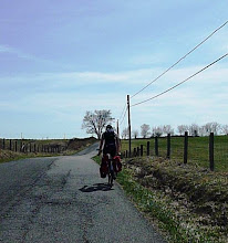
I started the morning with another fantastic meal made my Mr. And Mrs. Milam. After meandering through Garden of the Gods, (a park with unique red rock formations,) I started off from Woodland Park. For two days in Colorado Springs I stared anxiously at the sky waiting for the clouds to part and reveal Pike's Peak. It never happened. Maybe it is not a bad thing, as I am sure the supernatural size of the peak I am now imagining far outdoes the actual hilltop.

Riding into the mountains is a breathtaking experience. Literally, the altitude changes make it difficult to breath. I spent the last three nights at 6,000 feet- tonight at 10,000. Besides battling a frigid headwind, the difference in elevation is easily palpable and frustrating.

I was hoping to make it to a hostel in Breckenridge, but I was held up by winds. My dread of camping in below freezing temperatures with pending snow turned out to be unfounded. As I approached Fairplay I saw a yellow rescue squad sign and decided to try my luck. After knocking on the door of the station and pleading my case, I was shown the shower, leftover food in the fridge, and a place inside to sleep. Amazing!


Friday, May 14

Day 33- Thinking about the mountains

0 miles- Colorado Springs, CO

After very little deliberation I decided to take another day off at the Milam’s in Colorado Springs. Strong winds, pending snow/rain, and other reasons that came to me very easily, compelled another day of rest. When I leave tomorrow, I will still be a day ahead of the original planned goals. The clouds have been low for the past few days so I still cannot see Pikes Peek. Tonight there is a winter weather advisory for 4 to 6 inches of accumulation in areas of higher elevation. Right now I am just above 6,000 feet; by tomorrow night I will be above 9,000 feet.

A couple people have asked me if I have had any great revelations since leaving and what I do to pass the time during long stretches on the road. As far as change, all I can think of is that I have become increasingly conservative. A friend told me not to worry- after a week back in good blue states like Oregon and Washington I will be all balanced out and “right” again. We will see. I pass the time on the bike by thinking about all sorts of random minutiae. I will often start laughing randomly during desolate rides as my mind wonders. Going through the Appellations and Ozarks I made up long convoluted stories of epic heroes conquering the world. (Thinking I am the hero and each hill in front of me is the world.) Hopefully this is as introspective as this blog gets. After two days of I am itching to go again!

Thursday, May 13

Day 32- A view of the mountains

0 miles- Colorado Springs, CO

--- NEW PHOTOS UP --- (LINKS ON RIGHT)

I am taking a relaxing day off with the Milam family in Colorado Springs. As if to warn me of what is to come over the next few days... it is snowing. Wonderful!

Mr. and Mrs. Milam took the day off to show me around the city. Even though the clouds would not high enough to reveal Pikes Peak, the place is stunning. As we drove around I noticed bike lanes and cyclists everywere. Hopefully this will make heavy traffic easier to get through.

As I plan out the rest of the trip I am probably going to cut from Oxbow, Oregon straight to Seattle, Washington rather than going to the coast and heading north. By cutting out several nights at the end I am hoping to enjoy the Tetons, Yellowstone, and everything thereafter a bit more. As of now I am two days ahead of schedule!

Day 31- A test of will

116.4 miles- Kit Carson to Colorado Springs, CO

While falling asleep last night I was not afraid of wild people or dangerous animals, but of killer tumbleweed. I have been told that when it gets rolling it can damage cars and buildings. The winds last night were 25mph, almost tearing the tent apart. With no cover I was dreaming of an army of tumbleweed in triangle formation coming for me.

Today I battled one of the harshest forms of environment- nothing. The land for 100 miles leading up to Colorado Springs is far more bare than any of Kansas- really quite spectacular. Unfortunately, as I approached the city expecting a rush of elation when the mountains appeared, clouds hid all but an outline of the infamous peaks. I ended the long day with the parents of a good college friend and my second beer in the last month.


Tuesday, May 11

Day 30- Long white line

104.0 miles Leoti, kansas to Kit Carter, Colorado

I woke up this morning dry, warm, and well rested. Unbelieveably, I had a subtle tail wind again all day today- amazing luck. I left the fertile flatlands and entered the dry high plains country that extends from the far west edge of Kansas through most of eastern Colorado. The land is obviously far less productive. The crops look more like low bushes than produce and the ground seems to be composed entirely of sand. There was little to look at other than the long white line that stretched forever in front of me, and nothing to do but try to keep my wheels on the line for as long as I could. A thrilling game!

Today I passed near the site of the Sand Creek Massacre. In 1864 Colonel John J. Chivington marched 700 troops towards the Cheyenne Indian camp. Colonel Chivington told his men "I don't tell you to kill all ages and sexes, but remember our slaughtered women and children." Survivors estimate that of 500 Indians, 150 were killed. Immediately after the battle, the army was applauded for disposing of thieves and murderers. However the army later condemned the decision.


Monday, May 10

Day 29- Big Tornado County

114.4 miles- Rush Center to Leoti, KS

I packed the camp site this morning in the rain, not knowing the day I was in for. I was riding through desolate country- cars only passed once every ten minutes- a house went by every several miles. I could not tell whether there was nothing between me and the horizon in each direction or whether the persistent fog was blocking signs of civilization. About 50 miles in, halfway through "Long Thin Dawn" on my ipod, I heard the foreboding shake of thunder from behind. I turned to see an enormous black cloud closing in. Facing forward again, I realized how dark the sky in front of me had become. For the first time today the desolation and realization of "no place to hide" struck me like a wave. Except for the telephone poles, I was the highest object to attract lightening; except for drains under the roads there shelter was few and far between. With this relization came never before discovered motivation. For ten miles I pounded out 20mph on flat windless ground. I reached a town just in time to see the warm system (that has been my tailwind for the past few days) from the east meet the cold front from the southwest. Five minutes after reaching the gas station hail started hailing down and the clouds began to spin right in front of me. The picture tells the rest of the story.

I started to talk to Charlie and Pat Norton who were on there way back home, but taking shelter from the imminent tornado. After some friendly talk about the apocalypse outside and the area, they offered to take me in for the night. Little did I know I was staying with a Kansas celebrity. Charlie and Pat are a bronze artists and sculpted one of the eight wonders of Kansas. The largest bronze piece of Buffalo Bill stands in Oakley and is historically correct in every detail. You can see more of his amazing work at http://www.charlienortonbronze.com/.

I have learned a lot from the Norton's during my brief time with them. On the way home I was told that this area of western Kansas is known for its cattle feedlots. Cows from around the country are brought here to feed for 90-180 days (depending on the desired marbilization or fat of the meat) on the rich regional produce before taking them to slaughter. In the large slaughterhouse here, over 5,000 cattle are processed a day. I also discovered that the large co-op buildings that are everywhere (there was a picture yesterday) are full of last years harvest being cooled and dried by enormous fans. While much of this is sold for food, some is reserved for feedlots and making ethanol.


Sunday, May 9

Day 28- A Kansas Milestone

92.5 miles- Nickerson to Rush Center, KS

After more than 200 miles, I finally feel like I am in Kansas. Today my first piece of tumbleweed rolled across the road ten feet in front of me. The feeling was pure unaltered exhilaration! The land has also flattened considerably. Fields full of cows are being being replaced by endless tracts of unfenced lush green crops. When the wind blows the entire landscape, from the road to the horizon, looks like green flowing water. The long thick streaks of cloud in the enormous afternoon sky was as spectacular as the rippling land beneath it.

Today passed through Larnead. Besides the large co-op grain buildings (pictured) that are in every town, the Santa Fe Trail passes through the city. The trail was the main trading route between Missouri and Mexico during the 1800s and was heavily guarded. Travelers along the trail faced constant attack from disgruntled displaced Indians. Fort Larnead still stands several miles west of town that was used to house soldiers protecting the trail and nearby railroads. For me the importance of the fort lay in the first clean bathroom I have found in a long time.

The winds were howling from the southeast most of today. Not a tail, but they certainly helped. Started with rain that tapered by midday.