Saturday, May 22

Day 41- Wind River Indian Reservation

78.3 miles- Lander to Dubois, WY

The Wind River Indian Reservation is one of the most wealthy reservations in the US because of the rich natural resources that lie beneath its surface. The reservation was originally for the Shashonee tribe led by Chief Washakie. During the late 1800's (he lived to be over 100 years old) he realized that his people must assimilate and accept the ways of the whites to survive. He was rewarded by being given the ability to choose the land his people were to keep- the land that is now Wind River. I passed by the site of one of Washakie's famous victories. He avoided a war between his and another tribe by challenging the Chief of the enemy to a one-on-one fight on the top of what is now Cowheart Butte (pictured) to save the lives of their youth. The rumor is that Chief Washakie ate the heat of his enemy to absorb his courage, and the enemy tribe left.

The landscape has changed dramatically again. The cycle of glaciers that have covered this area of the country have created glacial moraine, ridges of gravel and rock that were pushed up and left as rolling hills in the shadow of the Wind River Mountains.

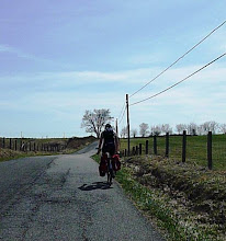
The wind of Wyoming is destructive to ones determination. Today was 45 degrees and sunny with winds at 10 to 30 mph as a head and cross-head. As I climbed from just below 6,000 feet to just below 7,000 feet the wind became stronger and colder. This combined with snow to make for another superb day. I looked at my map and saw the mountains below Dubois marked as "Windy Ridge." I really was hoping the people who named it were merely being facetious rather than descriptive.

Tonight Dubois will be setting a record low for this time of the year. Tomorrow morning I am hoping the Togwotee Pass will be open so I can get to the Tetons!


Friday, May 21

Day 40- White-out

70.1 miles- Jeffrey City to Lander, WY

I trained for this ride during the epic eastern snowfalls of 2010. A month before I left I said to myself that I would not be able to bare the sight of snow again. I saw it while in Colorado Springs, the Hoto Pass, Breckenridge, etc., but its presence was not offensive and did not bother me. The snow in Wyoming, however, was offensive. It was Offensive Snow. This morning I packed up the tent, ate a pack of peanuts, and was on the road with the sun on the horizon and temperatures in the 30's before 6:45. I raced to a rest area 20 miles away, indicated on my map as having bathrooms. As I warmed up inside I looked out the window. Utter dismay washed over me as I saw the white-out. Buckets of large flakes were invading the land around me and gutting my ride. My Dutch friend (the guy I met also doing the Transamerica a few days ago) pulled into the rest stop shortly after I did. We waited out the onslaught inside for two hours.

The landscape remained rocky and barren until 30 miles into today's ride when I dropped about 1,000 feet to Lander. As I descended the snow disappeared, the temperature rose from 31 to 45 degrees, and the land looked increasingly fertile. As Charlie Norton said to me back in Kansas, the country before Lander should never have been broken by man. The sight of green fields, cows, and productive land created a warm familiar feeling inside me. (The feeling was not actually the sight of the land, but sensation returning to my fingers and toes.)

Tonight I am staying with a family from the warmshowers cycling website. After a quick shower, we are going out for a few drinks.

Day 39- Jeffrey City

70.4 miles- Rawlins to Jeffrey City, WY

The land here is flat and barren, broken only by mountains of only the most erosion-resistant rock. Apparently I passed by some items of note, although I did not notice a thing. Just east of Jeffrey City is "Split Rock," a cleft in the top of low hills and buttes that was used by Indians, trappers and pioneers to guide them in the absence or roads.

On my map, Jeffrey City looked like a barren town in a barren land. This did not do justice to its actual miserable dilapidation. Every store is closed except one cafe/bar- every building has been blatantly abandoned. I stopped for an early dinner there. The waitress there was not overtly rude. Even with this dilapidation someone mowing around the empty buildings in an attempt to achieve expert lawn tidiness. I was hoping to sleep in a church or an RV park and get a shower, but as those are closed I am camping in between two abandoned buildings. I will be bear-bagging my food tonight (i.e. putting it in a bag as far away from my tent as possible.) Tonight is also the first night during this entire trip that I have not had cell coverage for miles in either direction, so this post will go up tomorrow.


Wednesday, May 19

Day 38- A Perfect Storm

42.4 miles- Saratoga to Rawlins, WY

Began the day with one of the best breakfasts at a small cafe, and ended the day with a comfortable motel. The time inbetween was spent in the perfect storm of cycling misery. When 40 degree temperatures plus unrelenting rain combine with a 20mph headwind, the result is hopefully the worst day of the trip. I stopped at the first gas station 20 miles from Saratoga. When I asked if I could warm up for a bit the owner/attendant said "For a bit, then you gotta leave."

I could not get the camera out at any point, but for about five miles a herd of deer followed me along the road. There are enormous fences on both side of the route I was on, and they could not get away from me until they found an opening. (I think the fences are there to prevent snow drifting on the roads.) Yesterday at a gas station I saw a picture of a local mountain lion that someone had shot- it was the size of an African lion! To pass the time I started thinking of what I would do if it were a heard of mountain lions following me. I couldn't come up with any "good" solution.

Tuesday, May 18

Day 37- Saratoga's sulphur springs

72.4 miles- Walden, Colorado to Saratoga, Wyoming

I finished today in the town of Saratogo, Wyoming. The city has many sulfur hot springs along the Platte River, one of which is walled off as a public hot tub the size of a swimming pool. The water cycles through every four hours and is a comfortable 110 degrees. I would never have gotten out if it were not for approaching thunder.

During the afternoon I was racing storms to finish today's ride. As the idea of a campground along the city reservoir sounded a bit wet (i.e. no cover), I stopped at the city museum to ask if I could camp under their gazebo. When I walked in the group of fifteen women became immediately silent and stared up at me blankly. Finally one of them said no, but to come back later. After a quick lunch, I returned to find her and a friend alone in the building. They were very friendly, informed me that I could camp (but some of the other ladies didn't like it,) and explained some of the towns history. Until recently, the main industry here was lumber. However, the mill closed six years ago, the Union Pacific closed the rail line, and the town has instead thrived on tourism. During the winter this is one of the best places for snow-mobiling and bathing in sulfur springs. This is a place I will be coming back to!


Monday, May 17

Day 36- South East Asia

80.6 miles- Kremmling to Walden, CO

Late morning during my climb to Willow Creek Pass (at 9,621 feet) I ran into Kees, a cyclist from Holland who had left Washington DC on April 2nd. For a fellow in his 60's he was moving very quickly. He had worked in advertising for many years, retired early, and took up biking eleven years ago. He has ridden all over the world including Europe, Turkey, and South-East Asia. He told me that in Vietnam one has to be very careful while asking for directions. If you ask if you are going the right way, the locals consider it rude to tell you anything but yes. Instead you must ask the question several different ways. " Is this the way to Saigon" - "Yes" - "Is there perhaps a second road to Saigon" - "Ahh yes, turn around!"

The landscape today was phenomenal. The sun illuminated the snow-capped mountains, and the wind was pleasantly non-existent. The last few hours I spent on an enormous plain leading up to Walden. After spending dinner listening to Kees' amazing stories I set up the tent in the town park, and can barely keep awake. Wonderful day.


Sunday, May 16

Day 35- A view from the top

80.4 miles- Fairplay to Kremmling, CO

The fire station I stayed at last night is the highest in the United States. The people there were great and the place was surprisingly comfortable. Five miles after leaving this morning I passed a similar landmark, the highest town in the United States. Alma was founded as a mining town but is now kept alive by the heavy winter and summer tourism.

The highlight of the day was climbing from Fairplay, just shy of 10,000 feet, to the Hoosier Pass, at 11,542 feet. The snow was heavy, the air was cold, and the elation was high. It is the continental divide and the highest I will go during this trip. The climbing yesterday and this morning were well worth the 50 mile downhill that followed.

Breckenridge stands on the far side of the Hoosier Pass. The town stands out because it lies in the shadow of a ski resort (that looks like all runs are still open!) Because the town caters to tourists and vacation homes, it is kept very well, no buildings look in disrepair, and everyone seems like they are in a great mood.

By the end of the day I had dropped down to about 7,000 feet to Kremmling. The town is dominated by enormous cliffs on its western edge. I found a hostel run by a Slovakian couple who came to the country two years ago. After a year in Florida they decided they missed the mountains of eastern Europe and came out here. They took especially good care of me and moved a TV into my room (which would normally they reserve for their more expensive hotel rooms.) Another night out of the mountains cold!