Saturday, May 29

Day 48- Bitteroot Valley

76.9 miles- Wisdom to Hamilton, MT

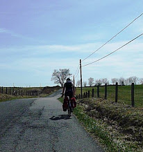
As I lay in my bed I listed for the sound of rain coming down outside- silence. As I looked out the window I looked for signs of precipitation- puddles everywhere. As I rode out of Wisdom I smelled the air- apparent dampness in the distance. I expected another miserable cold wet day. Instead the dark clouds could do nothing but spit.

While leaving Big Hole I passed the Big Hole National Battlefield, the site of a significant battle during the Nez Pierce War. The Nez Pierce Indians had been promised land by the United States government in the Wallowa Valley. When this policy was reversed, the Nez Pierce, under the leadership of Chief Joseph, decided to escape to Canada in hopes of better treatment. A group of young Nez Pierce men, angered by the forced exodus, slaughtered several white families in the area. Several weeks later, US Calvary forces launched an attack on about 800 Nez Pierce camped at Big Hole. Both sides suffered casualties. In October 1877, Chief Joseph surrendered only 40 miles before reaching the Canadian border.

A few miles after the battlefield I starred in disdain at the wet snowplow coming towards me. As I came closer to the top of Chief Joseph Pass, the amount of snow on the ground and trees grew precipitously. While it was snowing lightly at the top, I crossed the Pass at 7,264 with enormous relief. I am quite sure that I will not climb above even 6,000 feet again during this trip. As I coasted down the repetitive wages of warmer air brought feeling back to my fingers and toes. I followed the Bitteroot River along the narrow Bitteroot Valley until I reached Hamilton at about 3,000 feet. The valley is dotted with signs denoting significant parts of the first white expedition through the valley in 1805, made by Lewis and Clark. The beginning of the valley is narrow, with just enough room for the road, river, railroad track, and small plots of land squeezed in between the mountains. As it widens, the towns of Darby and Hamilton remain beautifully overshadowed by the Bitteroot Mountain Range.


Friday, May 28

Day 47- Rocky Mountain Oysters

71.4 miles- Dillon to Wisdom, MT

Had a wonderful night in Dillon with my first couch surfing night. Kurt guides back-country tours through the mountains of Wyoming and Montana and Eve is a soil scientist with Natural Resources Conservation Service around here. Again, I learned more about the area than I even remember to write down.

Kurt is the first person I have met who did the bikecentenial Transamerica ride in 1976 that was the precursor to the trail and maps that I am using today. He recounted a woman in Afton, Virginia who was known by everybody who traveled the route from 76 to at least 09. She had a water spout in her garden and would run out with cookies when she saw cyclists filling up. He also recalled a time in Kentucky when his group was sleeping in the basement of a Baptist church in a dry county. A couple friends tracked down some moonshine and saved the group from the dirges of a dry county.

I had made peace with the fact that today was going to wet and miserable. Thankfully I was picked up by quite the renaissance woman. She ran a cattle ranch with her family, worked at a local ski resort, and ran the motel in Wisdom- my destination for the day. After driving through pouring rain and over a couple snowy passes we entered Big "Hole", a Montana colloquialism for valley. I got a room to escape the frigid rain and walked down the street to find food. At The Big Hole Restaurant I tried rocky mountain oysters for the first... and last time.

Thursday, May 27

Day 46- Beaverhead Rock

51.9 miles- Alder to Dillon, MT

At the library in Twin Bridges I bumped into the guy to built the cyclists campsite there. After he described the services there I lamented to him that I did not take advantage of the place. The place has a gazebo, showers, and a beautiful river-side location- (all without the high-way robber of KAO campsites.) Quite a few towns along the Transamerica cycling route have places like this, and its amazing that people donate the time, effort, and money for people to stay.

I spent most of my time in the library frowning at the weather reports. As I began to plan the last leg of my route through Washington I logged onto warmshowers.org and couchsurfing sites to see if there was any escape from the elements. Using couchsurfing successfully for the first time, I unbelievably found someone to stay with in Dillon. With such a short day, I wanted to do more miles up to Jackson, but camping at about 6,700ft. As road to Dillon was about 5,200ft and raining, there is a good chance if I pushed onto to Jackson I would find myself in another white-out!

I passed by Beaverhead Rock today, so named by Lewis and Clark. I forced myself to stop and take a picture as I need someone to explain to me how it looks like a beaver! (Will put the picture up as soon as I can.)


Wednesday, May 26

Day 45- Montana

96.3 miles- West Yellowstone to Alder, MT

I passed through some beautiful country today. As I started off I was on a desolated lake surrounded by snow-capped mountains. The place was deserted except for a few workmen building log style hotel cabins along its edges. All I could hear for the twenty miles I followed the resevoir was the sound of oarlocks in my head. It would be the flattest and most stunning place to row that I have ever seen in this country.

As I continued descending, I left the snowcapped mountains and entered Madison Valley. The area is characterized by the miles of openness and low population towns like Wyoming. However, the number of resorts and shops catering to tourists shows that this place is given far more attention. Fly fishing seems to be the biggest attraction, taking advantage of the wide, shallow, and low-banked Madison River.

Towards the end of the day I climbed 2,000 feet in 6 miles to Virginia City and Nevada City. They reminded me of towns like Staunton, VA in that all the old buildings were preserved with exhibits of their original use. They were old mining towns that are obviously survived by tourism.

The weather today was the best it has been in weeks and I was on a high. I was planning on doing 70 miles but didn't want to stop. I can take pictures again, but my phone (which I use to write these posts and upload photos) does not seem to read my camera card. This means that I can only upload pictures from libraries. I will try to get to them as often as possible.


Tuesday, May 25

Day 44- Yellowstone National Park

77.1 miles- South Yellowstone, WYOMING to West Yellowstone, MONTANA

With a few inches of snow on the ground and the South Gate of Yellowstone closed, I was off to a rocky start. I enjoyed breakfast with a couple who was preparing to do a supported (i.e. instead of bags they use a van and driver) ride from West Yellowstone back the way I had come to Colorado. When I finally entered the park, the snow was deep and the weather was cold. After climbing up for 35 miles and across the continental divide three times the ride rinally began to look up. By Old Faithful I was in lower elevation and had left the snow and frigid weather behind.

Towards West Yellowstone gysers and bison became were around every turn. For the most part, the bison ignored the cars and lone cyclist. Even a mother sitting next to her newborn a few feet from the road did nor bother to chase away onlookers. I was very worried, however, when I caught a particularly mean bison looking at me (which was rare in itself) like the cows from Missouri just before they called the herd to chase.

After the desolate beauty of Wyoming, Yellowstone was a bit disapointing. Holistically, the crouds make the experience dull and unexciting. Speeding campers and touring buses are a far cry from the one-car-an-hour I have become all too comfortable with.

(Water two nights ago did not destroy my camera or phone, but looks like my camera card is useless. Losing my pictures since Colorado has been devistating. I should be able to find another and have more pictures up then.)


Day 43- The No-Teton National Park

21.8 miles- Signal Lake Campground to Flag Ranch Campground, WY

First- my excuse for the short distance is that my plan was to start the day by going about 15 miles south to Moose Junction, a point along Jackson Lake, to see the Tetons in their entirety. However, when I woke up this morning, I found them completely covered in cloud. That was not the only surprise that awaited me this morning. I awoke to a quarter inch of snow on the ground and half the inside of my tent covered in water. While the water did not render my warm riding clothes useless, it soaked my wool socks (essential when riding in twenty and thirty degree weather) and drenched my camera. After sitting for half an hour in dispair, I packed up and headed north to a resort lodge. I found the enormous lobby and, ignoring the prying glances of the staff, spread out my socks and electronics in front of the fire for a few hours. While I did not lose my camera, I am quite sure I lost all my photographs since Colorado, which is far far far more tragic. Without a memory card I also have lost the ability to take pictures (except with my phone) through Yellowstone.

As I continued towards the gates of Yellowstone, planning to camp just outside, drenching snow started to tumble from the sky. Luckily, a workman in a truck picked me and took me ten miles to Flag Ranch as the road was gravel and mud due to construction. Expecting temperatures about twenty degrees and two more inches of snow, I paid for an exuberantly priced, minimally serviced cabin for the night. (Second night during trip without cell service, so late post.)

I am watching heavy snow come down outside, hoping that the limited sunshine predicted tomorrow comes to fruition. Yellowstone Park only opened a week ago due to unseasonable weather. The good news is that the place is not flooded with tourists until after memorial day. The bad news is the unseasonable weather and the fact that many restaurants, camp sites, and other services do not open until this weekend. I suppose I will have to come back- and next time I will definitely be in a car.

Sunday, May 23

Day 42- Hogwatee Pass and Grand Teton National Park

64.5 miles- Dubois to Signal Mountain Campground, WY

I started today with a 30 mile climb from Dubois, at around 6,000ft, to the top of the Hogwatee Pass, at 9,658ft. I continued to follow the Wind River until it dissipated into nothing towards the continental divide. As I came closer and closer to the top, the snow on the ground turned from thin and light to dense and heavy. The temperature dropped from 35 back down into the 20s while a short snow shower came and passed. My hard work was well rewarded when I reached the 17 mile 6% grade to the base of the Grand Teton Mountain range. This morning I wondered how I would know them when I saw them, but it could not have been more obvious. I headed south on Teton Park Road and set up camp on the edge of Jackson Lake.

The are is very commercialized, and after being in the boonies for so long the light to moderate traffic feels like DC rush hour. Also, I am camping around other people for the first time... ever I think. As long as none of the people are bears I should be fine. For the next two days I will be constantly on the watch for bears. To signal my approach I will be singing "Surfin Bear," my spin-off of the old "Surfin Bird" song. Tomorrow I will mosey around Teton Park in the rain and finish up camping just outside Yellowstone in hopeful anticipation of sunny skies by Tuesday.